
Drone Mapping, 3D Models & Orthomosaic Mapping
Drone mapping revolutionizes traditional ground surveys by leveraging aerial UAV technology to produce centimeter-accurate 3D models, topographic maps, and volumetric data quickly and efficiently. This innovative approach enhances work safety, significantly reduces operational costs, and provides project teams with real-time visual updates on progress.

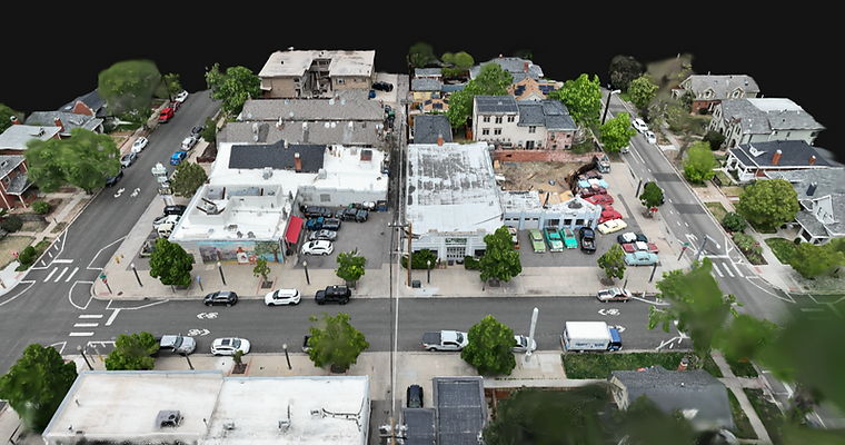


Construction Site Mapping
Drone mapping gives contractors, developers, and project managers a comprehensive view of every stage of construction. High-resolution orthomosaic maps and 3D models provide accurate documentation of site conditions, helping teams monitor progress, coordinate subcontractors, communicate with stakeholders, and maintain detailed project records. Regular mapping flights create a visual timeline that makes it easy to compare changes and keep projects on track.
3D Models & Orthomosaic Maps
Our drone mapping services produce detailed 3D models and orthomosaic maps that offer far more than traditional aerial imagery. Orthomosaic maps combine hundreds of high-resolution photos into a single, geometrically accurate image that can be used for planning, measurements, and documentation. Interactive 3D models allow clients to visualize terrain, structures, and project sites from virtually any angle, providing valuable insight throughout every phase of a project.
Land Development & Site Planning
Developers, engineers, architects, and property owners use drone mapping to better understand existing site conditions before construction begins. Accurate aerial data helps evaluate terrain, identify site features, improve planning, and support project coordination. By capturing an up-to-date view of your property, drone mapping provides valuable information that helps reduce uncertainty and improve project efficiency.
Recurring Mapping & Progress Documentation
Many projects benefit from scheduled drone mapping throughout construction or development. Recurring flights generate consistent orthomosaic maps and updated 3D models that document changes over time and provide reliable progress records. Whether performed weekly, monthly, or at key project milestones, recurring mapping delivers valuable historical data that supports reporting, communication, and long-term project management.
Request a Drone Mapping Quote
Send A Message
Whether you need an orthomosaic map, an interactive 3D model, or recurring drone mapping throughout your project, AeroScope Innovations is ready to help. Contact us today to discuss your goals, request a customized quote, and learn how professional drone mapping can provide the accurate data and aerial insight your project deserves.